View Piece
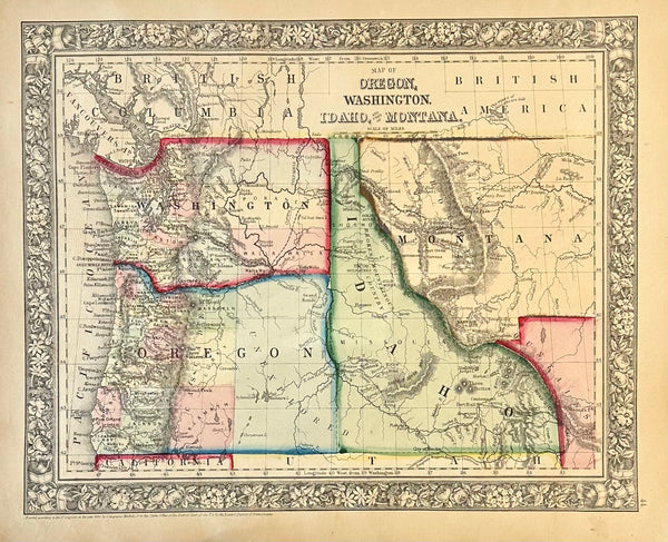
Map
Oregon, Washington, Idaho & Montana Original Engraving by Samuel Mitchell, 1863
$165
View Piece
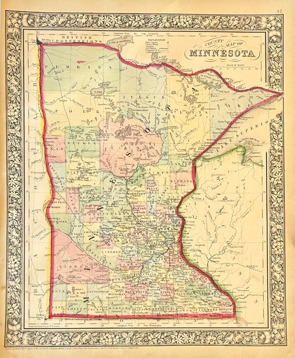
Map
Minnesota, Original Engraving by Samuel Mitchell, 1863
$165
View Piece
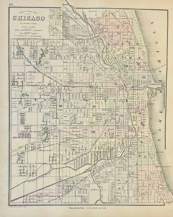
Map
Chicago, Original Engraving by Gray, 1870
$215
View Piece
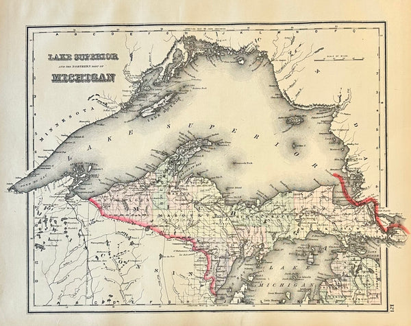
Map
Michigan & Lake Superior Original Engraving by Samuel Mitchell, 1863
$145
View Piece
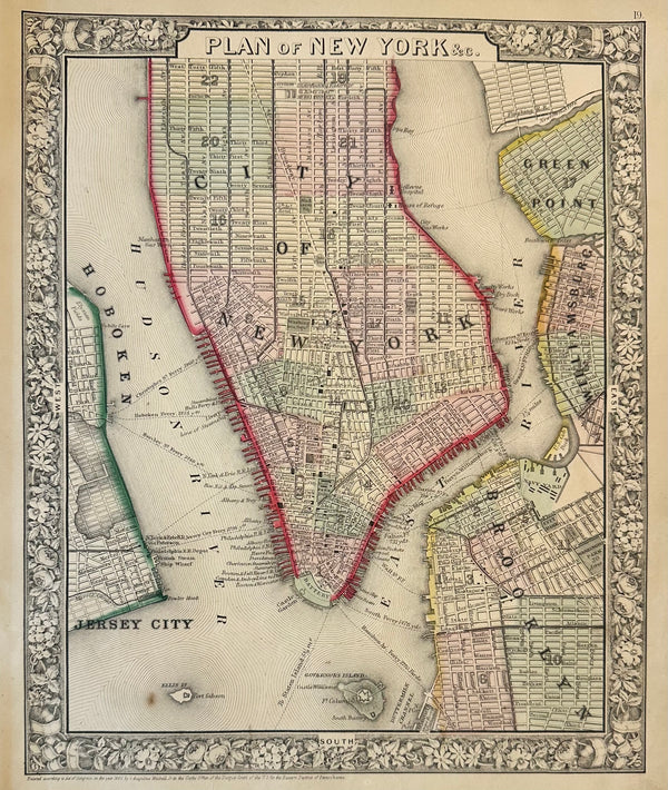
Map
New York City by Samuel Mitchell, 1863
$275
View Piece
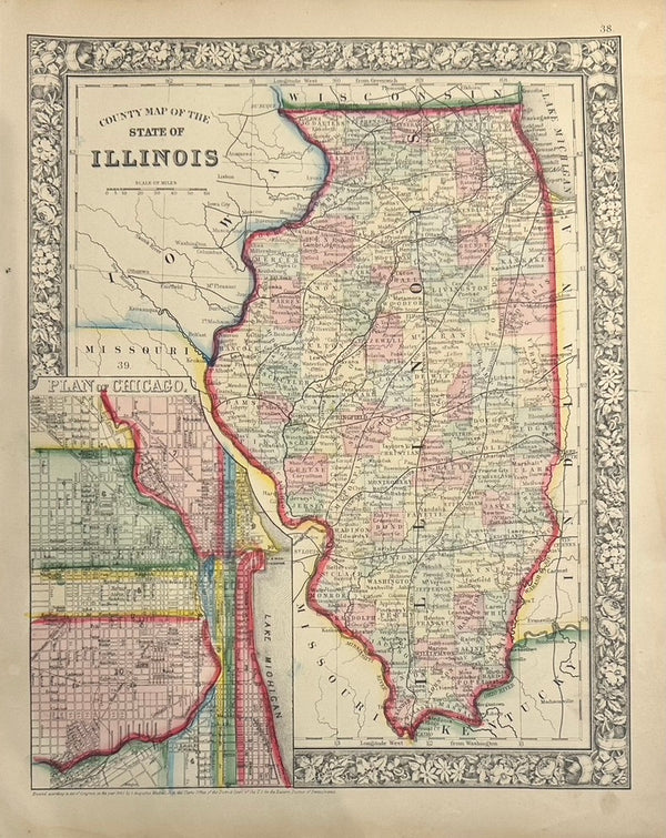
Map
Map of Illinois with Plan of Chicago Inset by Samuel Mitchell, 1863
$185
View Piece
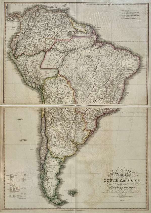
Map
South America & Columbia by Faden 1823
$1,850
View Piece
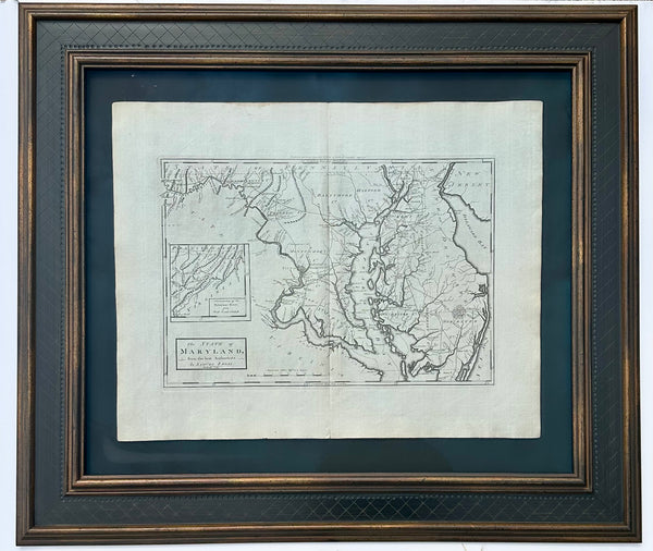
Map
Maryland, 1st edition by Matthew Carey, 1795
$2,150
View Piece
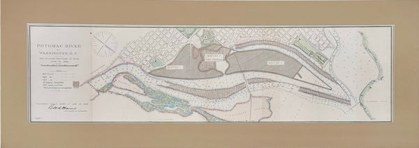
Map
Potomac River, Original Coastal Chart, 1885
$225
View Piece
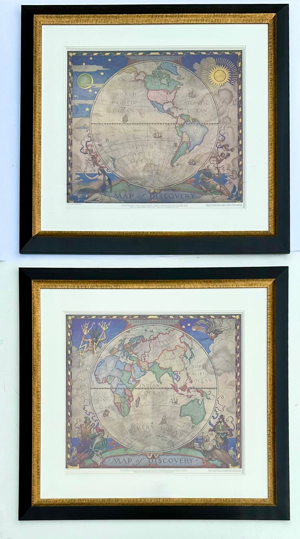
Print
Maps of the World, N.C. Wyeth. Lithograph, 1928 (Pair)
$1,850
View Piece
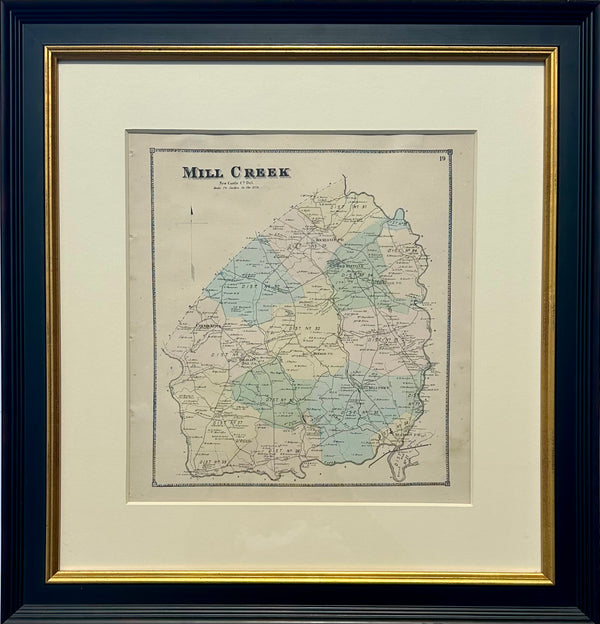
Map
Mill Creek Hundred, Delaware (Mid 19th Century Original Framed Engraving)
$450
View Piece
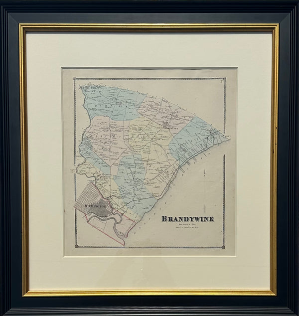
Map
Brandywine Hundred, Delaware (Original framed engraving, 1868)
$450
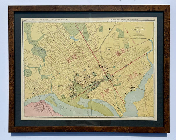
View Piece
Map
Washington, DC by McNally, 1897
$465
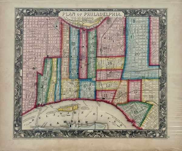
View Piece
Map
Philadelphia by Samuel A. Mitchell, 1860
$145
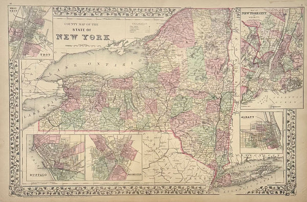
View Piece
Map
New York & Counties by Samuel A. Mitchell, 1881
$200
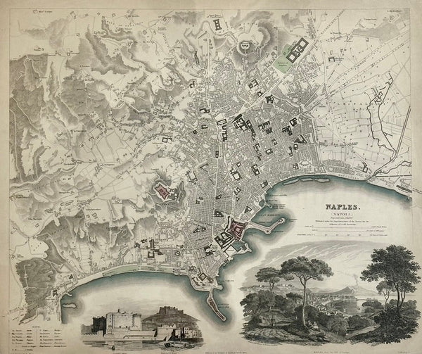
View Piece
Map
Naples Map by Baldwin, 1835
$125
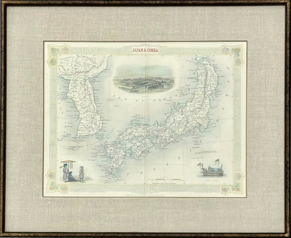
View Piece
Map
Japan & Korea by Tallis, 1851
$225
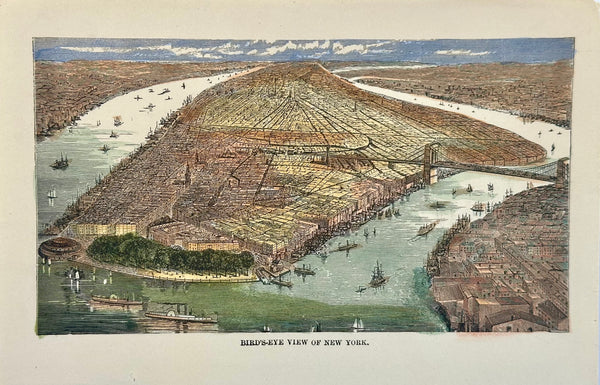
View Piece
Print
New York City Birds Eye view, circa 1890
$95
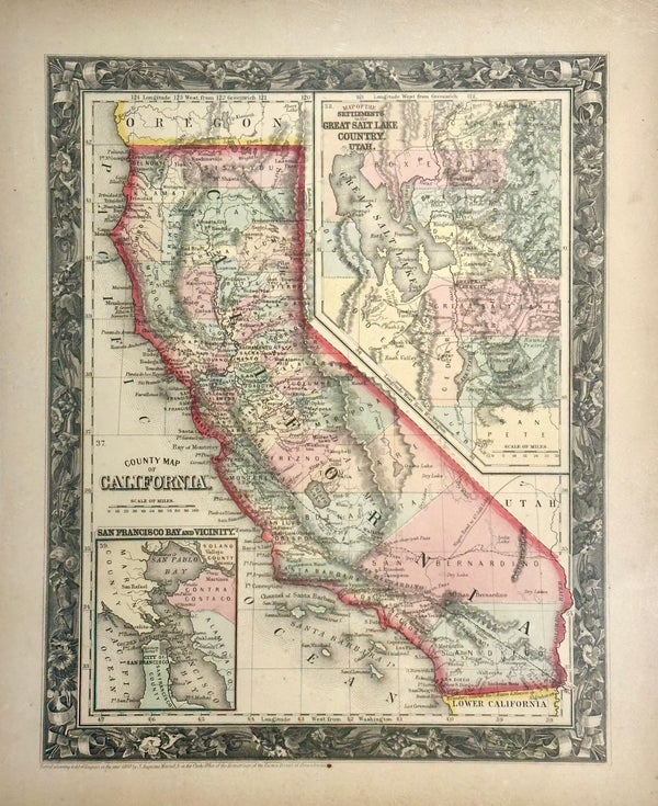
View Piece
Map
California by Mitchell, 1860
$175
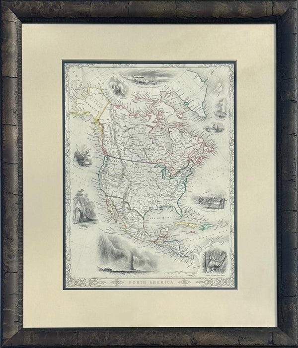
View Piece
Map
North America Map by Tallis, 1851
$375
View Piece
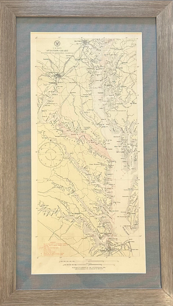
Map
Baltimore, Washington, Norfolk Aviation Chart of Chesapeake, 1925 (Framed)
$425
View Piece
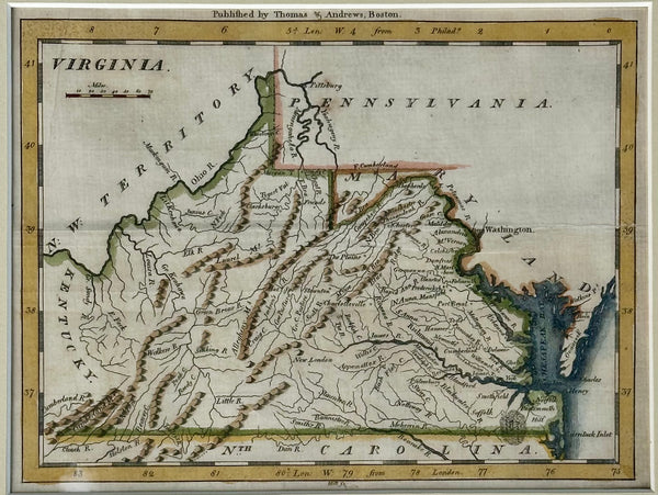
Map
Viriginia from Morse’s Universal Geography, 1796
$425
View Piece
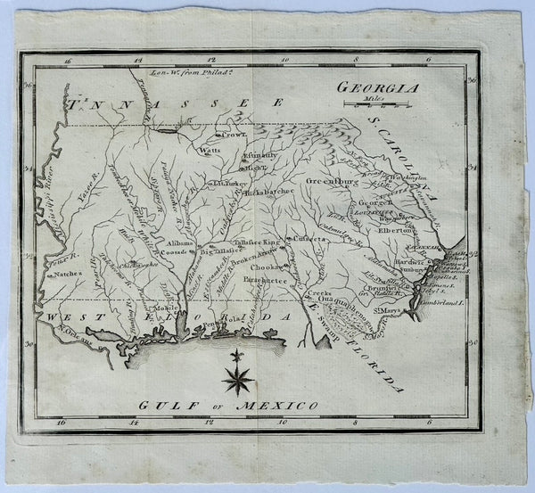
Map
Map of Georgia & West Florida by Joseph Scott, 1795
$325
View Piece
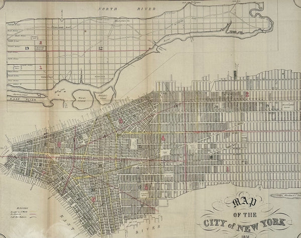
Map
New York City Lithograph, 1851 – Original from Valentine’s Manual (21 × 17¼ in.)
$395