
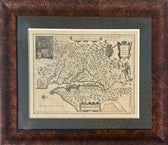
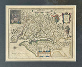
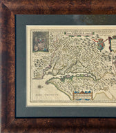

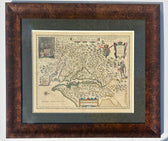
Map
Virginia & Chesapeake Bay Map from Capt. John Smith By Willem Blaeu, 1618
$2,850
Guaranteed Authentic Original
Original copper engraved rare map was derived from Capt. John Smith's map of 1612 was the first to accurately depict the Chesapeake Bay and its tributaries. The early settlement of Jamestown is noted and there are several other place names, both English and Native American. In the upper left corner is an engraving of the great Indian chief, Powhatan, seated...
- TypeMap
- AuthenticityDocumented · guaranteed genuine
★Framed by hand in our Ocean View studio — backed by Brandon's 25+ years of custom framing.
● Free delivery throughout coastal Delaware
● In-home hanging available
You May Also Like
— From the Collection —
View Piece
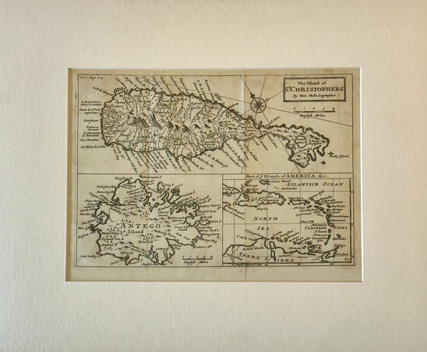
Map
1716 St. Kitts, Antigua & Caribbean — By Herman Moll Atlas Geographicus
$500
View Piece
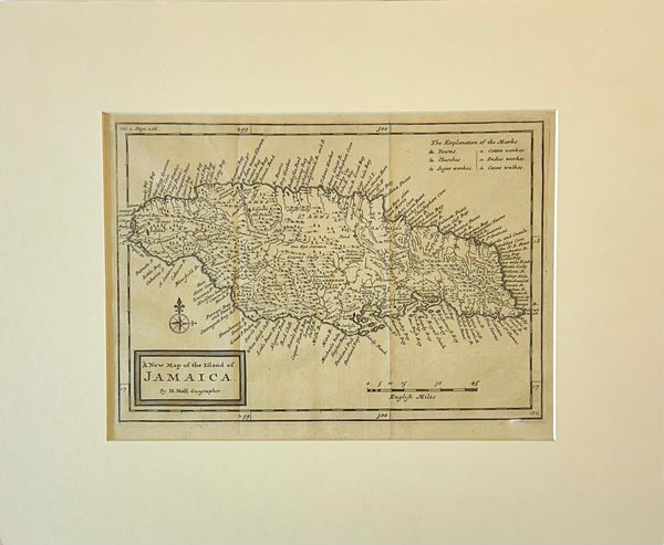
Map
Jamaica by Herman Moll — London, 1716 (Atlas Geographicus)
$650
View Piece
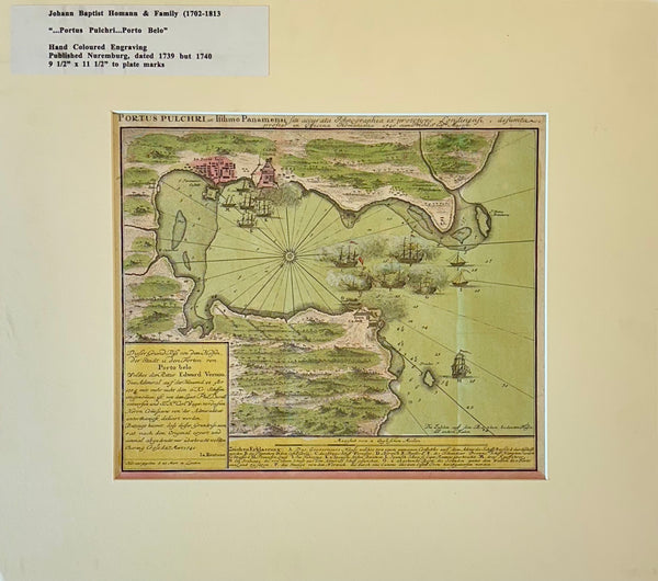
Map
1740 “Portus Pulchri (Porto Bello, Panama)” Johann Baptist Homann Hand-Colored Engraved Harbor Map
$400
View Piece
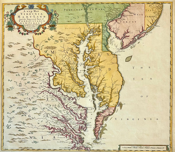
Map
Chesapeake Bay: Virginia, Maryland, Pennsylvania & New Jersey Original Map by Senex, 1721
$5,200