
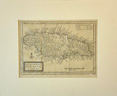
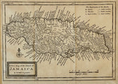
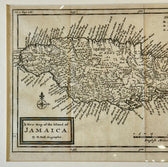
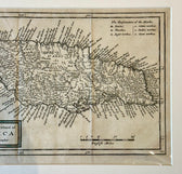
Map
Jamaica by Herman Moll — London, 1716 (Atlas Geographicus)
$650
Guaranteed Authentic Original
A finely engraved early 18th-century map of Jamaica by renowned London cartographer Herman Moll, published in 1716 in his important atlas Atlas Geographicus. This compact yet highly detailed copperplate map presents the island with exceptional clarity, identifying towns, churches, plantations, rivers, harbors, and coastal features during the height of the British colonial period. Moll’s maps are prized for their historical...
- TypeMap
- AuthenticityDocumented · guaranteed genuine
★Framed by hand in our Ocean View studio — backed by Brandon's 25+ years of custom framing.
● Free delivery throughout coastal Delaware
● In-home hanging available
You May Also Like
— From the Collection —
View Piece
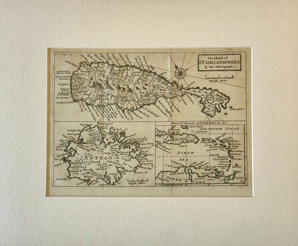
Map
1716 St. Kitts, Antigua & Caribbean — By Herman Moll Atlas Geographicus
$500
View Piece
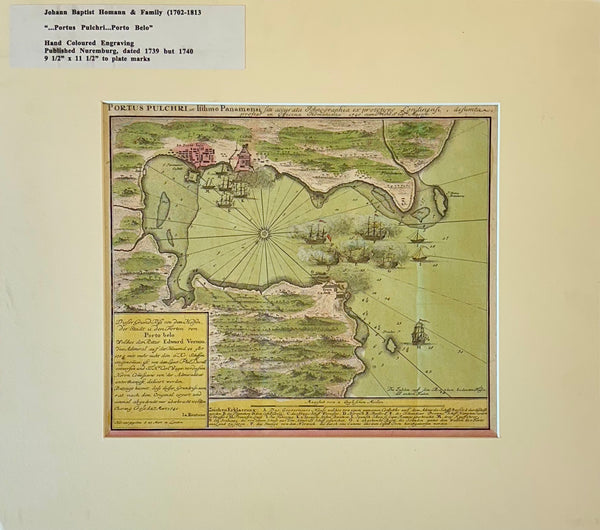
Map
1740 “Portus Pulchri (Porto Bello, Panama)” Johann Baptist Homann Hand-Colored Engraved Harbor Map
$400
View Piece
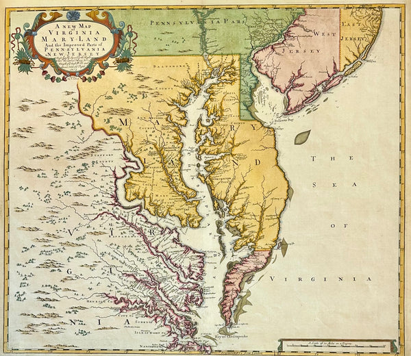
Map
Chesapeake Bay: Virginia, Maryland, Pennsylvania & New Jersey Original Map by Senex, 1721
$5,200
View Piece
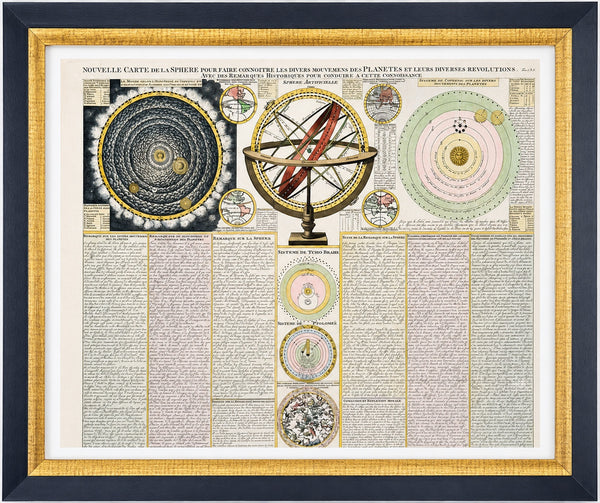
Print
Antique Celestial Chart, Spheres & Astronomy of the Sun, Planet, and Moon Orbits by Henri Abraham Chatelain, 1718
$1,100