
Map
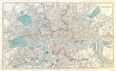
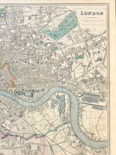
Map of London, England & Thames by Edward Stanford, 1857
$650
Guaranteed Authentic Original
An original 1857 engraved map of London by Edward Stanford, issued as part of Plans of the Principal Cities of the World in 1857. This finely detailed mid-19th-century city plan captures London during the height of the Victorian era, centered along the River Thames and extending across Westminster, the City, and surrounding districts. Printed with exceptional clarity and enhanced with...
- TypeMap
- AuthenticityDocumented · guaranteed genuine
★Framed by hand in our Ocean View studio — backed by Brandon's 25+ years of custom framing.
● Free delivery throughout coastal Delaware
● In-home hanging available
You May Also Like
— From the Collection —
View Piece
Map
Vintage Delaware Pictorial Map by Taylor, 1935 – Original Custom Framed Map
$395
View Piece
Map
Delaware & Maryland Map by Luke Drury, 1822
$625
View Piece
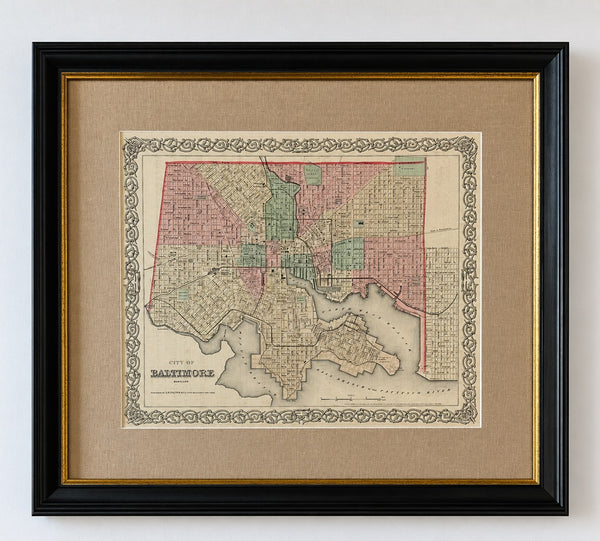
Map
Antique Baltimore, Maryland City Map | Hand-Colored Engraving | Custom Framed
$525
View Piece
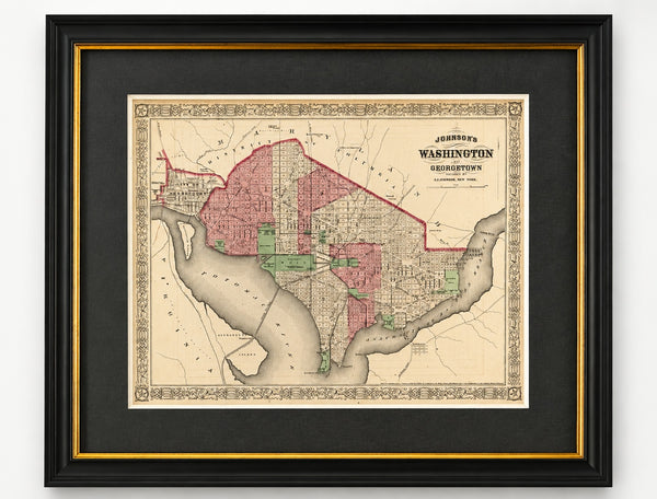
Map
Washington, D.C. & Georgetown Map by A.J. Johnson, Circa 1868, Custom Framed
$550