
Map
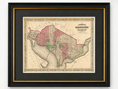
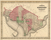
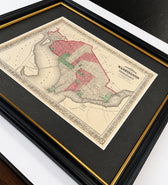
Washington, D.C. & Georgetown Map by A.J. Johnson, Circa 1868, Custom Framed
$550
Guaranteed Authentic Original
Original steel engraving of Washington and Georgetown was published by A.J. Johnson as part of his renowned New Illustrated Family Atlas of the World. Johnson's atlases earned international recognition, receiving prize medals at the Paris Universal Expositions of 1867 and 1878. Known for their fine engraving, original hand coloring, and distinctive ornamental borders, Johnson maps are among the most desirable...
- TypeMap
- AuthenticityDocumented · guaranteed genuine
★Framed by hand in our Ocean View studio — backed by Brandon's 25+ years of custom framing.
● Free delivery throughout coastal Delaware
● In-home hanging available
You May Also Like
— From the Collection —
View Piece
Map
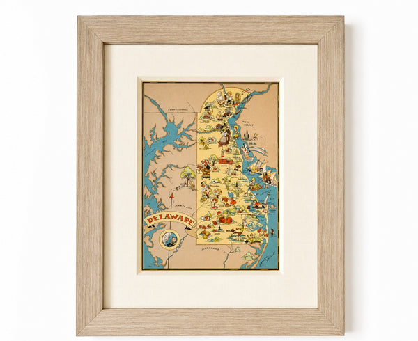
Vintage Delaware Pictorial Map by Taylor, 1935 – Original Custom Framed Map
$395
View Piece
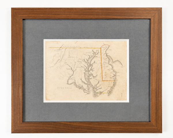
Map
Delaware & Maryland Map by Luke Drury, 1822
$625
View Piece
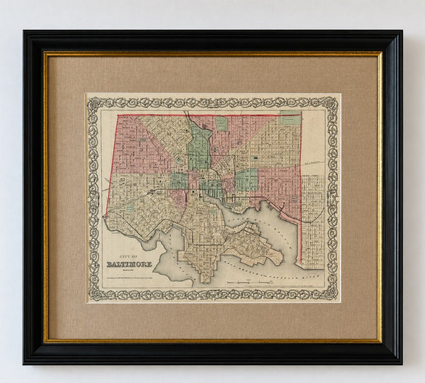
Map
Antique Baltimore, Maryland City Map | Hand-Colored Engraving | Custom Framed
$525
View Piece
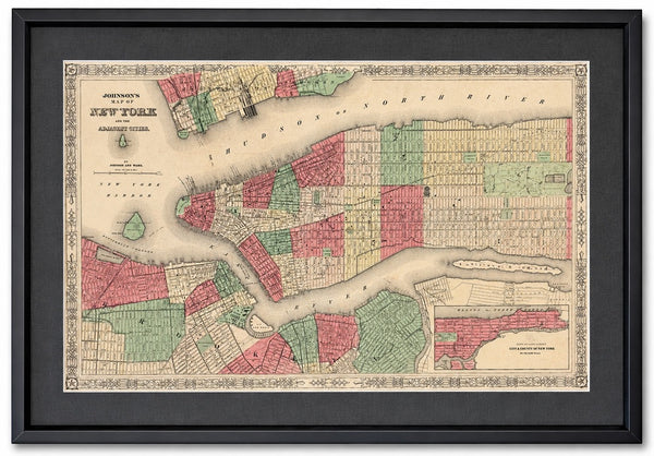
Map
New York City & Brooklyn Map by Johnson, Framed (Circa 1864)
$600