
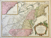
Map
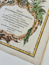
Map of the Eastern United States and Ohio River Valley by Vaugondy, 1755
$1,200
Guaranteed Authentic Original
Original copper engraving by Robert de Vaugondy, Paris, 1755. Finely engraved and beautifully hand-colored mid-18th-century French map depicting the eastern portion of North America at the dawn of the French and Indian War—capturing the region just before large-scale westward expansion reshaped the continent. Titled Partie de l’Amérique Septentrionale, this important 1755 map illustrates the Ohio River watershed alongside the British...
- TypeMap
- AuthenticityDocumented · guaranteed genuine
★Framed by hand in our Ocean View studio — backed by Brandon's 25+ years of custom framing.
● Free delivery throughout coastal Delaware
● In-home hanging available
You May Also Like
— From the Collection —
View Piece
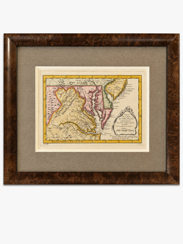
Map
Original 1757 Hand-Colored Chesapeake Bay Map by Jacques-Nicolas Bellin | Copper Engraving | Custom Framed
$650
View Piece
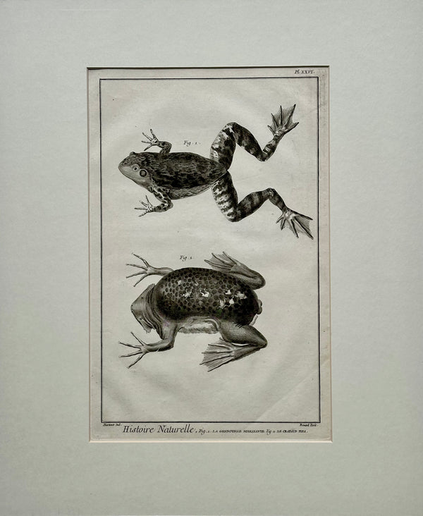
Print
American Bullfrog, Original Engraving by Buffon, 1775
$450
View Piece
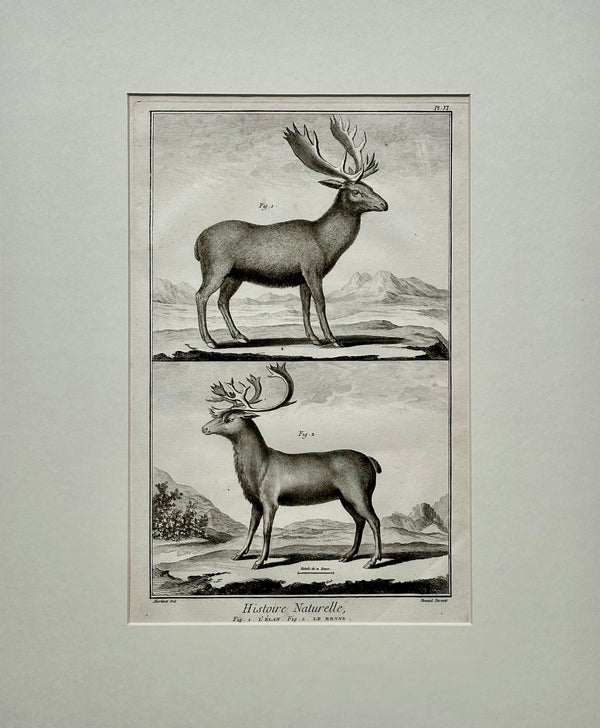
Print
Elk & Reindeer Original Engraving by Buffon, Circa 1774
$600
View Piece
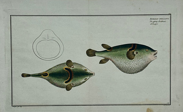
Print
Puffer Fish Original Print by Bloch, 1782
$225