View Piece
Map
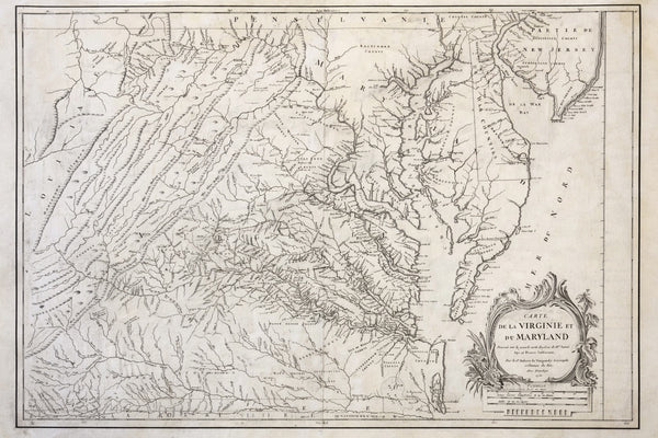
1755 Fry & Jefferson Map of Virginia and Maryland — “Carte de la Virginie et du Maryland” (Thomas Jefferson’s Father as Surveyor)
$2,100
View Piece
Map
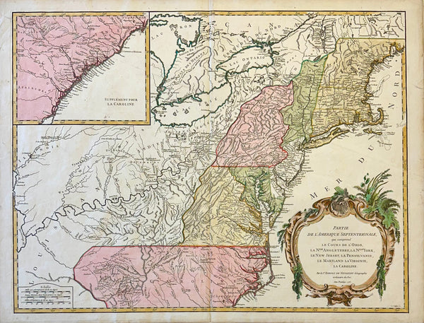
Map of the Eastern United States and Ohio River Valley by Vaugondy, 1755
$1,200
View Piece
Map
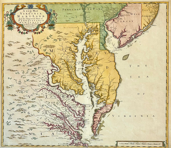
Chesapeake Bay: Virginia, Maryland, Pennsylvania & New Jersey Original Map by Senex, 1721
$5,200
View Piece
Print
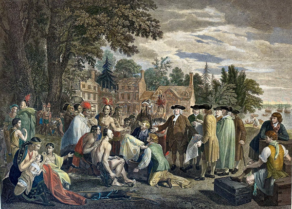
William Penn's Treaty with the Indians — Original Hand-Colored Engraving by Hall, circa 1771
$2,800
View Piece
Map
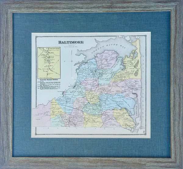
Baltimore Hundred in Sussex County, Delaware, Print from Beer's & Pomeroy, Framed
$250
View Piece
Print
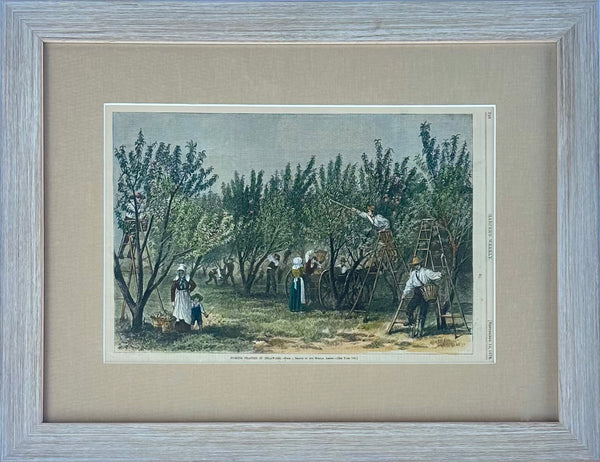
Peach Picking, Delaware Orchard - Hand-Colored Original Print, Framed (Dated 1878)
$345
View Piece
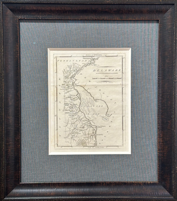
Map
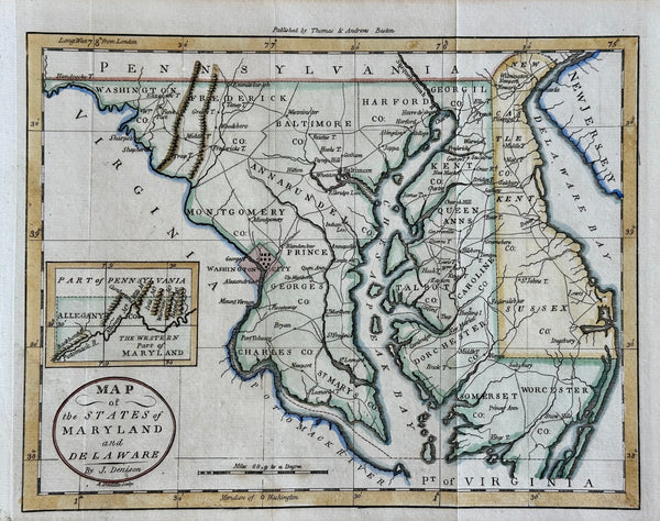
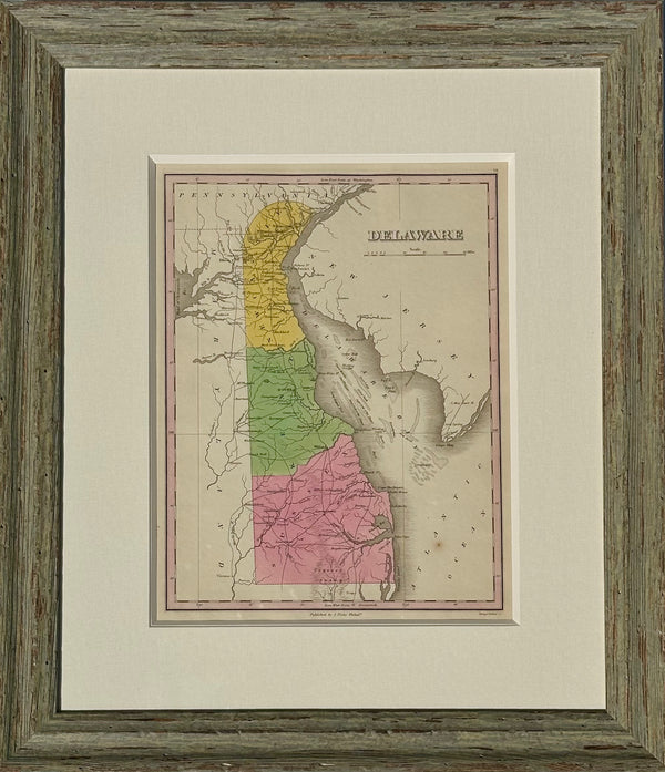
Maryland & Delaware Map by Morse, circa 1796
$525
View Piece
Map
Delaware, after Beers & Pomeroy (framed)
$300
View Piece
Map
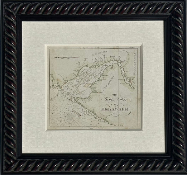
Coastal Chart: Bay & River of Delaware by Edmund Blunt, 1833 (framed)
$650
View Piece
Map
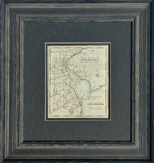
Map of Delaware by Matthew Carey, 1805 (framed)
$800
View Piece
Map
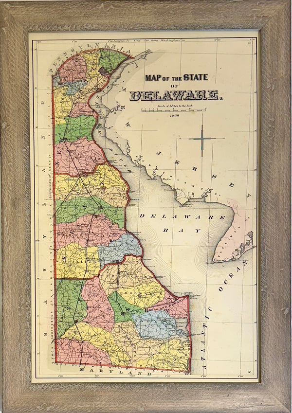
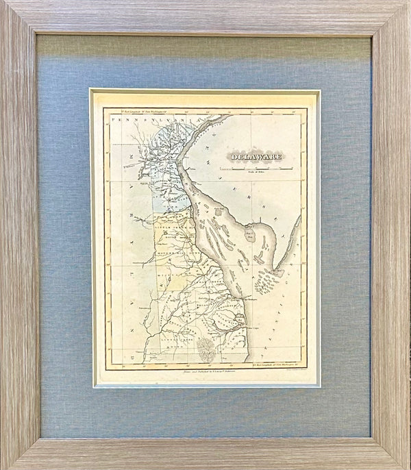
Map of Delaware by Anthony Finley, 1824 (framed)
$550
View Piece
Print
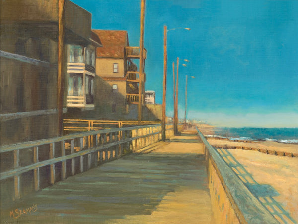
Bethany Beach Boardwalk by Martha Seamans (16 x 20")
$95
View Piece
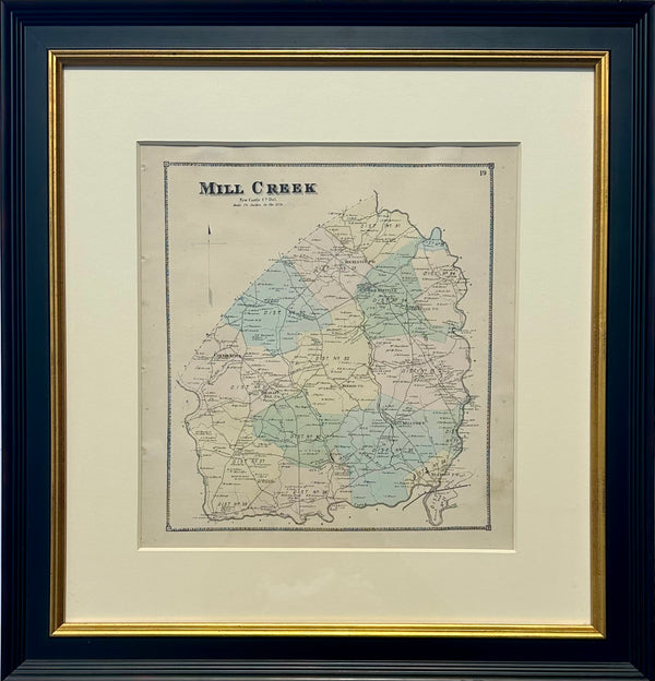
Map
Mill Creek Hundred, Delaware (Mid 19th Century Original Framed Engraving)
$450
View Piece
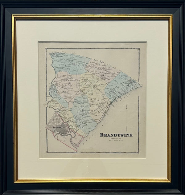
Map
Brandywine Hundred, Delaware (Original framed engraving, 1868)
$450
View Piece
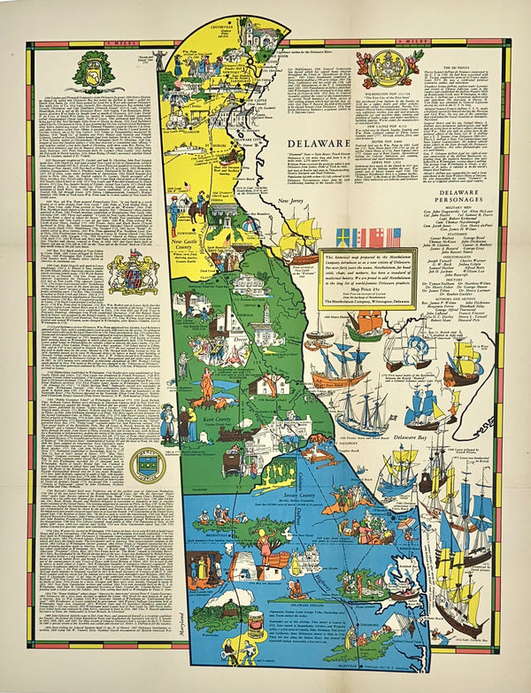
Map
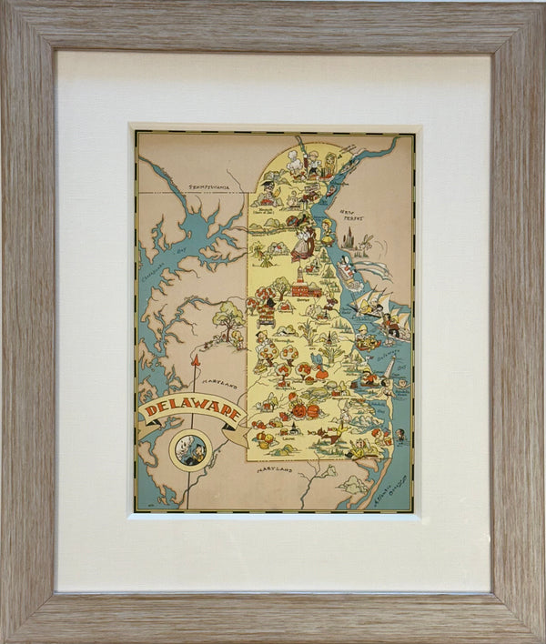
Pictorial Map of Delaware, 1937
$475
View Piece
Map
Map of Delaware by Matthew Carey, 1805
$625
View Piece
Map
Delaware by Fielding Lucas, 1823
$1,100
View Piece
Map
Vintage Delaware Map, 1935, framed
$325
View Piece
Map
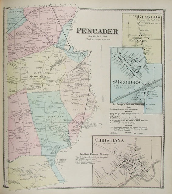
Pencader
$195
View Piece
Map
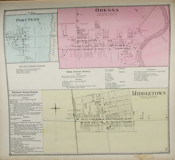
Odessa / Port Penn / Middletown
$195
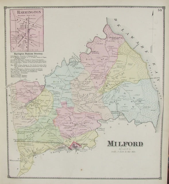
View Piece
Map
Milford
$195
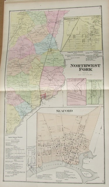
View Piece
Map
Northwest Fork (Seaford inset)
$195
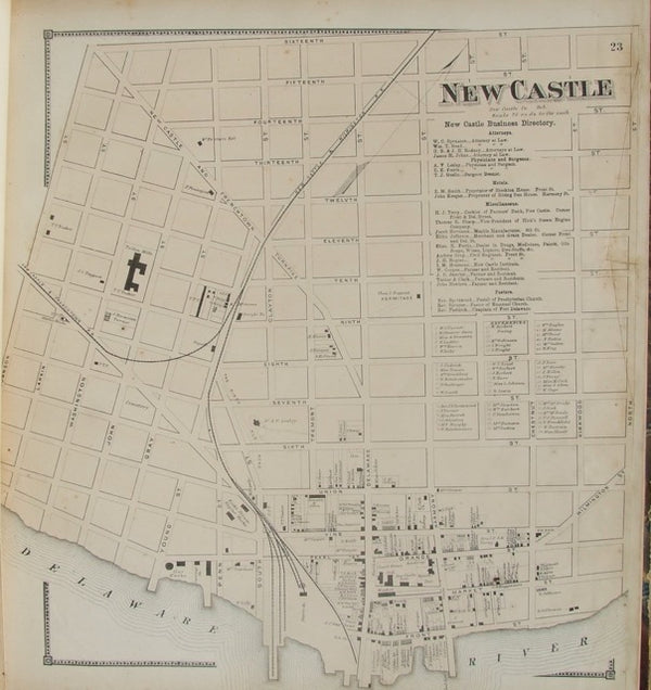
View Piece
Map
New Castle Street Map
$195
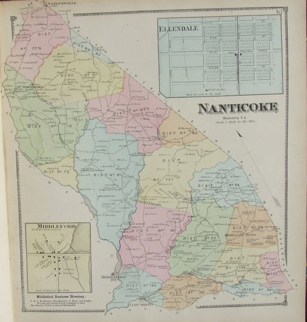
View Piece
Map
Nanticoke
$195