
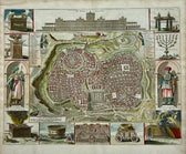
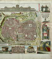
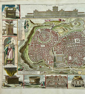
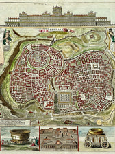
Map
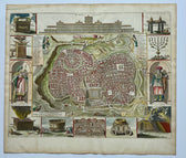
Jerusalem, Original Map by Daniel Stoopendaal, Circa 1710
$825
Guaranteed Authentic Original
Original antique copper engraving of a bird's-eye plan of Jerusalem, created by Daniel Stoopendaal. The depiction of the holy city is surrounded by engravings of religious icons, including representations of Solomon and a High Priest. At the top, there is an elaborate elevation of the Temple of Solomon, while the bottom features a plan of the Temple of Ezekiel. The...
- TypeMap
- AuthenticityDocumented · guaranteed genuine
★Framed by hand in our Ocean View studio — backed by Brandon's 25+ years of custom framing.
● Free delivery throughout coastal Delaware
● In-home hanging available
You May Also Like
— From the Collection —
View Piece
Map
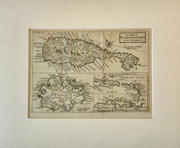
1716 St. Kitts, Antigua & Caribbean — By Herman Moll Atlas Geographicus
$500
View Piece
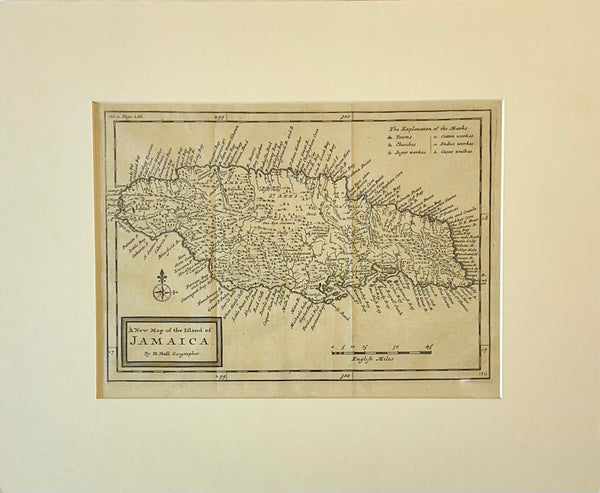
Map
Jamaica by Herman Moll — London, 1716 (Atlas Geographicus)
$650
View Piece
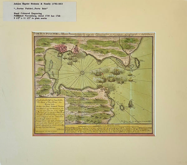
Map
1740 “Portus Pulchri (Porto Bello, Panama)” Johann Baptist Homann Hand-Colored Engraved Harbor Map
$400
View Piece
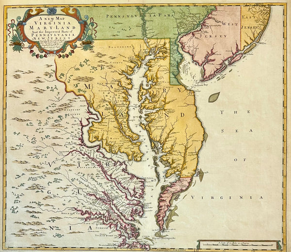
Map
Chesapeake Bay: Virginia, Maryland, Pennsylvania & New Jersey Original Map by Senex, 1721
$5,200